
This Island in Scotland Is Actually a Man-Made Mini Landmass Resting on a Wooden Platform, New Discovery Shows
Scientists made significant advances in underwater archaeology techniques and photogrammetry while investigating the crannog site
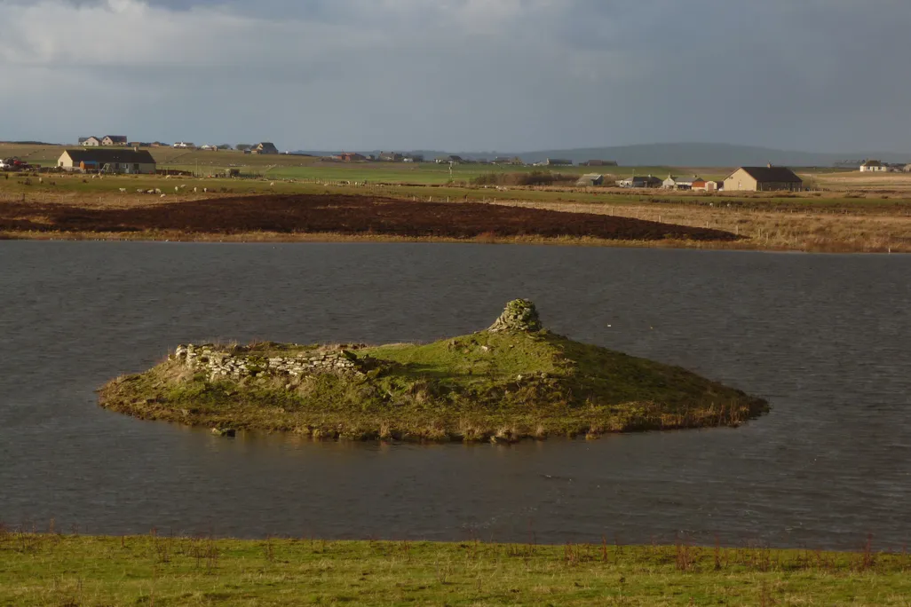
An example of a crannog, in the Loch of Wasdale
Derek Mayes via Wikimedia Commons under CC BY-SA 2.0
Aerial drone images over Loch Bhorgastail, one of the lakes that dot Scotland’s Isle of Lewis, show a small island long believed to be composed almost entirely of stone. But when archaeologists began excavating beneath the water’s surface, they made an unexpected discovery: The island has a foundation, and it’s a platform of timber.
“Before that, we didn’t know. We just knew that there were pieces of wood sticking out and that there must have been some sort of structure there,” Stephanie Blankshein, a maritime archaeologist at the University of Southampton who helped lead the discovery, says in a statement.
Blankshein is among the archaeologists studying the Loch Bhorgastail island as part of the “Islands of Stone” project analyzing the artificial islets, called crannogs, that occupy the lakes of Scotland and Ireland. Humans used clever engineering techniques to construct these little landmasses, which required “monumental effort” to create, said Fraser Sturt, a maritime archaeologist at the University of Southampton, to BBC News’ Norman Miller in 2021. Sturt is a researcher for the Loch Bhorgastail study.
Scotland’s hundreds of crannogs, largely concentrated in the Outer Hebrides, were long believed to originate no earlier than the Iron Age. But studies in the last decade began to suggest that some of them are much older, dating as early as the Neolithic era some 5,000 years ago, before Stonehenge was fully erected in England.
Aerial view of the islets in Loch Bhorgastail F. Sturt under CC BY-NC-ND 4.0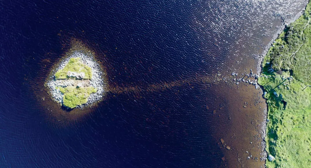
Blankshein and her colleagues were aware that the Loch Bhorgastail crannog contained some pieces of wood, but the latest excavation revealed the surprising size of the wooden structure, as well as the curious timeline of its construction.
Jack Pink, a researcher studying the use of robotics in underwater archaeology, observes in a blog post for the Advisory Council on Underwater Archaeology website that during the Loch Bhorgastail excavation, “rapidly the sediments are peeled back, revealing an astonishing layer of cut timbers, coppice-like roundwood, and huge sections of tree as thick as my thigh.”
The base of the crannog is a circular wooden platform, 75 feet across, covered in brushwood, that dates to roughly 5,000 years ago. On top of that is a layer of stone and more brushwood, added in the Middle Bronze Age, around 2,000 years later. There’s evidence that even more elements were added 1,000 years after that, during the Iron Age.
The “Islands of Stone” research team also investigated a stone causeway, visible beneath the water’s surface on a sunny day, that connects the crannog to the lake’s shore. Around the crannog and the causeway, they found pottery shards dating to the Neolithic period.
“While we still don’t know exactly why these islands were built, the resources and labor required to construct them suggest not only complex communities capable of such feats, but also the great significance of these sites,” Blankshein says in the statement.
Scientists speculate that crannogs may have once been ritual sites, or perhaps perches for high-status dwellings, though the details of their use remain a mystery for future research.
“Who would want to spend all of their time putting stones in a loch?” Vicki Cummings, an expert in Neolithic monuments, said to National Geographic’s Erin Blakemore in 2019. “It’s a crazy thing to spend your time doing.”
Fun fact: Say halò
Communities on the Outer Hebrides islands are some of the few places where people still speak Scottish Gaelic as a daily language.
But the archaeologists at Loch Bhorgastail made significant advances in technology used to study the artificial islands.
Archaeologists often use a technique called photogrammetry to create 3D models of artifacts and sites from photographs. These models help with analysis of the sites and also serve an important role in communicating the nature and importance of a site to the public. The shallow water environment typical of crannog sites poses a problem for photogrammetry, as the tools used for land survey cannot be used in water and typical underwater equipment needs a depth greater than a meter to function correctly.
“Fine sediments, choppy conditions, floating vegetation and distorted or reflected light all hinder shallow water imaging,” Sturt says in the statement. “This problem is a well-known frustration for archaeologists.”
To solve the problem, the team at Loch Bhorgastail mounted two small waterproof cameras a set distance apart. A diver then moved the cameras through the water, capturing many imperfect but overlapping images of the site that were later compiled to create a comprehensive 3D model.
This method, which could prove useful for photogrammetry not just in crannogs but also in previously difficult-to-map coastal archaeological sites around the world, was published last month in the journal Advances in Archaeological Practice.
“This method is both accessible and efficient, offering a replicable framework for recording archaeological sites at the water’s edge,” write the study’s authors.